Our Data
The Strait of Georgia Data Centre holds data for ecological, environmental and human use data for the Strait of Georgia. The term “Data” is used here in its broadest sense. It is important for us to include information in a variety of formats, including traditional data held in spreadsheets and databases, processed data for direct input to GIS systems and models, existing maps and images, historic photographs, and videos.
Please note that the contents of the SDGC are not complete – this is an ongoing process!
- Access the Strait of Georgia Data Centre Marine Data BC open data portal.
- Do you have data? Please see our data submission form.
- See our data sharing agreement here.
Design of the Data Portal
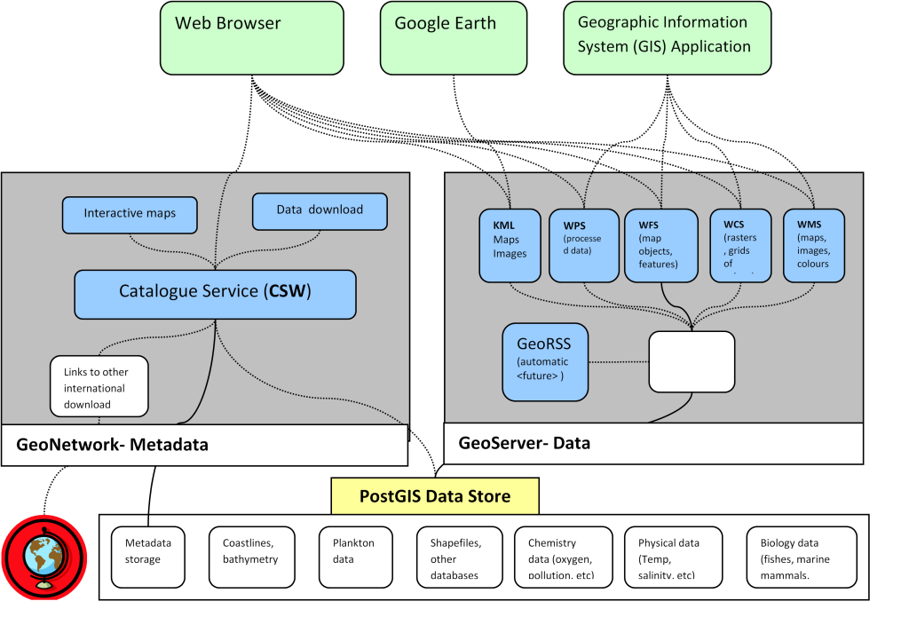
The Strait of Georgia Data Portal is built on three main open source applications:
- Re-projection to other coordinate systems so all the data aligns properly
- Conversion to raster overlays
- Output formats such as CSV for analysis, PDF for reports, and many others
- Completely compatible with all international standards, facilitating both access and sharing
- No licencing costs
- Rapid application development cycles
In the figure below, one can see the three blocks for GeoNetwork, Geoserver, and Datastores, and the functions they provide. The details are probably only of interest to technicians – however, the important point is that the user has a multiplicity of ways of accessing the data and metadata.
There is an international association of organizations creating websites exactly similar to the SoGDC, with the title “Coastal Atlases”. The association is called International Coastal Atlas Network (ICAN), and it has recently (July 2013) become a UNESCO ‘project’. The benefit of ICAN is that it permits data searches across organizational boundaries, where compatible datasets exist. Of local significance, the states of Washington, Oregon, and California are all members of ICAN.
ICAN has a semantic search system so that datasets described in different terms can be found. A dataset example might be ‘shoreline’, which might be described by others as coastline, or high or low water line. The SoGDC datasets are being documented according to ICAN conventions, and the SoGDC website will be fully compatible.